Drawn from Absence: The Artists Restoring America's Erased Waterways Through Maps and Memory
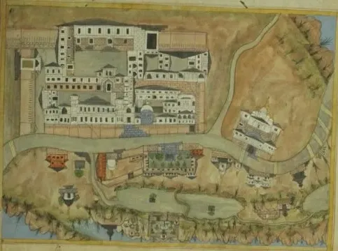
Photo: Sahib Ram, Public domain, via Wikimedia Commons
Beneath the concrete channel that carries the Los Angeles River through fifty-one miles of the city's basin, there is—or rather, was—something considerably more complex. Before the Army Corps of Engineers encased it in the 1930s and 1940s, the river shifted course seasonally, braided across a wide floodplain, and supported riparian ecosystems that extended deep into what are now residential neighborhoods. The concrete is a solution to flooding. It is also, in the estimation of a growing number of artists and cultural geographers, a form of erasure—one that has severed a major American city from its own hydrological identity.
The Los Angeles River is perhaps the most visible example of a phenomenon that has reshaped urban and rural landscapes across the country: the systematic disappearance of waterways. From the buried streams of New York City to the re-engineered watersheds of the Midwest's agricultural belt, American geography is underlain by a shadow hydrology—a network of waters that once existed and have since been rerouted, drained, dammed, or simply paved over. A distinct cohort of contemporary artists is now making that shadow visible.
The Cartographic as Creative Act
The tools these practitioners use are as varied as their geographic subjects. Some work in the tradition of historical cartography, producing hand-drawn maps that overlay pre-industrial waterway systems onto contemporary satellite imagery. The resulting documents are simultaneously archival and speculative: they show where water once moved through a landscape that no longer retains any surface evidence of its passage.
Others work in digital and interactive formats, building web-based map interfaces that allow users to toggle between historical and contemporary views of specific urban watersheds. These projects draw on a rich body of source material—nineteenth-century survey maps, Army Corps records, municipal engineering documents, and Indigenous geographic knowledge, where that knowledge has been made accessible through tribal partnerships. The act of layering these sources is itself a kind of argument: that the contemporary landscape is not a neutral given, but the accumulated result of decisions, many of them consequential and contested.
In Chicago, artists have collaborated with environmental historians to reconstruct the pre-drainage hydrology of the Chicago River system, which was famously reversed in 1900 to carry sewage away from Lake Michigan. The reversal transformed the river's relationship to the broader Great Lakes basin in ways that persist to the present day. Visualizing what the system looked like before that intervention—and making that visualization publicly accessible—reframes the river not as a fixed infrastructure asset but as a managed artifact with a history.
Experiential Methods: Walking the Ghost
Beyond the map, some artists are developing experiential methods for making absent waterways perceptible. Guided walks along the routes of buried urban streams have become a recurring format, combining elements of psychogeography, environmental education, and performance. In cities including Boston, Philadelphia, and San Francisco, participants are led through streets and parks that trace the courses of streams that now flow entirely underground through culverts and storm drains.
These walks are often accompanied by audio components—field recordings of the underground water, accessible through smartphone or dedicated audio devices—that make the subterranean current audible even as it remains invisible. The effect is consistently described by participants as disorienting in a productive sense: familiar urban spaces become layered with a hydrological presence that was always there but never perceived.
Some artists have extended this approach into more formally structured installations. Projections of historical water flow patterns onto contemporary street surfaces at night, temporary chalk or paint markings tracing stream courses across sidewalks and plazas, and augmented reality applications that overlay animated waterways onto smartphone camera views have all appeared in recent years as tools for what practitioners sometimes call "hydrological haunting"—the deliberate reintroduction of water's memory into a landscape that has suppressed it.
The Midwest's Invisible Drainage
While urban buried streams have received increasing public attention, the transformation of rural and agricultural watersheds represents an equally significant—and less visually dramatic—dimension of American water erasure. The tile drainage systems that underlie much of the Midwest's agricultural land represent one of the largest hydrological engineering projects in human history, one that converted millions of acres of wetland into productive farmland by routing water through underground ceramic and plastic pipes into ditches and streams.
The ecological consequences of this transformation—accelerated nutrient runoff, loss of wetland habitat, altered flood dynamics—are well documented. The cultural consequences are less often examined. Artists working in Iowa, Illinois, and Indiana have begun producing work that attempts to reconstruct what the pre-drainage landscape looked like and how it functioned: paintings, prints, and large-format photographs that draw on paleoecological data and historical accounts to depict the prairie potholes, fens, and wet prairies that once covered the region.
This work is not nostalgic in a simple sense. It does not propose that the drainage be undone wholesale or that agricultural productivity be sacrificed. What it does propose is that the landscape's current form be understood as a choice rather than a condition—a distinction that carries significant implications for how future water management decisions are framed and debated.
Indigenous Geographies and the Limits of the Archive
Any serious engagement with erased American waterways must contend with the fact that the most thorough records of pre-colonial hydrology are not found in survey maps or engineering documents, but in the geographic knowledge maintained by Indigenous nations whose relationships to specific water systems predate European settlement by millennia. Several artists working in this space have pursued formal and informal collaborations with tribal nations to incorporate Indigenous place names, water stories, and spatial knowledge into their work.
These collaborations are not without complexity. Questions of intellectual sovereignty, appropriate attribution, and the risks of romanticization or misrepresentation are present in every such partnership. The most thoughtful practitioners approach these relationships with sustained humility, treating Indigenous geographic knowledge not as supplementary color for their projects but as a primary epistemological framework that challenges the assumptions embedded in Western cartographic traditions.
When a river's Indigenous name is restored to a contemporary map alongside its Army Corps designation, something shifts in the viewer's understanding of what that river is and whose history it carries. That shift is, in its modest way, the point.
Water's Memory Is a Public Matter
At Aqua Mosaics, we understand water not merely as a physical substance but as a carrier of cultural meaning—a medium through which communities understand their own histories and their relationships to the landscapes they inhabit. The artists working with phantom rivers and erased waterways are, in this sense, engaged in a fundamentally public act: they are returning to shared landscapes a dimension of meaning that was stripped away, often without public deliberation, in the name of efficiency or flood control or agricultural productivity.
The maps they draw, the walks they lead, the projections they cast onto nighttime streets—these are not laments. They are arguments, rendered in the visual language of water, for a more complete accounting of what American landscapes have been, what they have lost, and what they might yet become. In tracing the outline of what is no longer there, these artists remind us that absence is itself a kind of presence—and that the waters beneath our cities have not stopped moving simply because we can no longer see them.